BlueVision
One platform. Five operational stacks. Decision-ready marine, coastal, port, environmental and aquaculture intelligence.
BlueVision Platform
BlueVision is a modular geospatial intelligence platform that transforms Earth Observation, UAV, airborne, marine and reference data into decision-ready hydrographic, coastal, marine and environmental products. Bathymetry can be delivered as a standalone product for hydrographic offices and survey authorities, or as a core layer inside broader monitoring stacks. The platform combines data ingestion, layer management, AI processing, post-processing, validation, visualization, reporting and GIS export in one workspace.
Primary Target Users
BlueVision can be configured for organizations that need repeatable, validated and export-ready marine geospatial intelligence, from hydrographic products to operational monitoring.
Hydrographic Offices & Survey Authorities
Bathymetric updates, SDB validation, uncertainty layers, contours, CATZOC/QoBD-style indicators and S-100/S-102-oriented products.
Ports, Maritime & Logistics
Access-channel monitoring, siltation and sedimentation mapping, dredging-support layers, turbidity and suspended-sediment context, challenging/risky-water screening for port operations and ballast-water management, vessel activity, anchorage intelligence, congestion awareness and operational-risk layers.
Coastal Authorities, Planners & Insurers
Shoreline change, erosion, accretion, storm impact, coastal exposure, infrastructure risk and decision-ready climate-resilience layers.
Environmental Agencies & Blue Economy Actors
Integrated intelligence for seabed, habitat, water quality, restoration, blue-carbon areas and protected marine zones, including turbidity, suspended sediment, chlorophyll-a, water-clarity context, coastal pressures, environmental-risk indicators, change-detection layers, reporting outputs, GIS products and planning dashboards.
Aquaculture Operators & Regulators
Repeatable monitoring of cages, floating assets and farm layouts, including cage drift, displacement, mooring-zone changes, infrastructure updates, water-quality context, algal-bloom risk, storm exposure, environmental pressures, alerts, reports, GIS layers and operational dashboards.
Five Configurable BlueVision Operational Stacks
BlueVision is not a set of disconnected products. It is a common platform where reusable analytical capabilities are combined into client-specific configurations. When needed, the platform can also run as a bathymetry-only workflow.
Bathymetry-Only Configuration
For hydrographic offices, survey authorities and clients that only need depth information, BlueVision can deliver AI bathymetry, isodepth lines, profiles, uncertainty, validation reports and S-100/S-102-oriented bathymetric outputs without activating a full monitoring stack.
Coastal Change & Climate Risk
Shoreline change, erosion and accretion mapping, storm-impact assessment, bathymetric baselines, depth-change trends, coastal exposure layers, GIS outputs and decision-ready reports.
Ports & Maritime Intelligence
Port and access-channel bathymetry, siltation monitoring, dredging planning, vessel presence, anchorage activity, congestion, traffic patterns, sediment plumes and operational-risk mapping.
Environmental & Blue Economy Monitoring
Seabed and habitat mapping, bathymetry context layers, seagrass and blue-carbon support, protected-area monitoring, turbidity, water clarity, river plumes, restoration baselines and environmental pressure layers.
Aquaculture & Marine Farm Intelligence
Cage and floating-asset detection, farm-layout and drift monitoring, bathymetry and exposure context, water-quality indicators, sensor integration, bloom risk, storm screening, alerts and dashboards.
Core Platform Capabilities
These reusable technical modules power the operational stacks above. Bathymetry is a primary BlueVision output and can be delivered alone or combined with monitoring, classification and reporting workflows.
Data Discovery, Acquisition & Image Suitability
Search and load EO imagery by AOI and date, assess water-covered pixels, integrate marine indicators and score image suitability before processing.
Through-Water Image Restoration
AI restoration reduces waves, sunglint, caustics and water-column artefacts, improving visual quality for bathymetry, classification and inspection.
AI Bathymetry
Generate bathymetry as a standalone product or stack layer from satellite, airborne, UAV and reference data, with contours, profiles, uncertainty and validation.
Refraction Correction
DSM/DTM-based refraction correction improves the geometry of shallow-water mapping products derived from aerial, UAV and photogrammetric datasets.
Bathymetry Gap Filling & Super-Resolution
Super-resolve coarse bathymetry and fill missing depth areas using AI and SfM-MVS support, producing more complete shallow-water surfaces.
Seabed & Habitat Classification
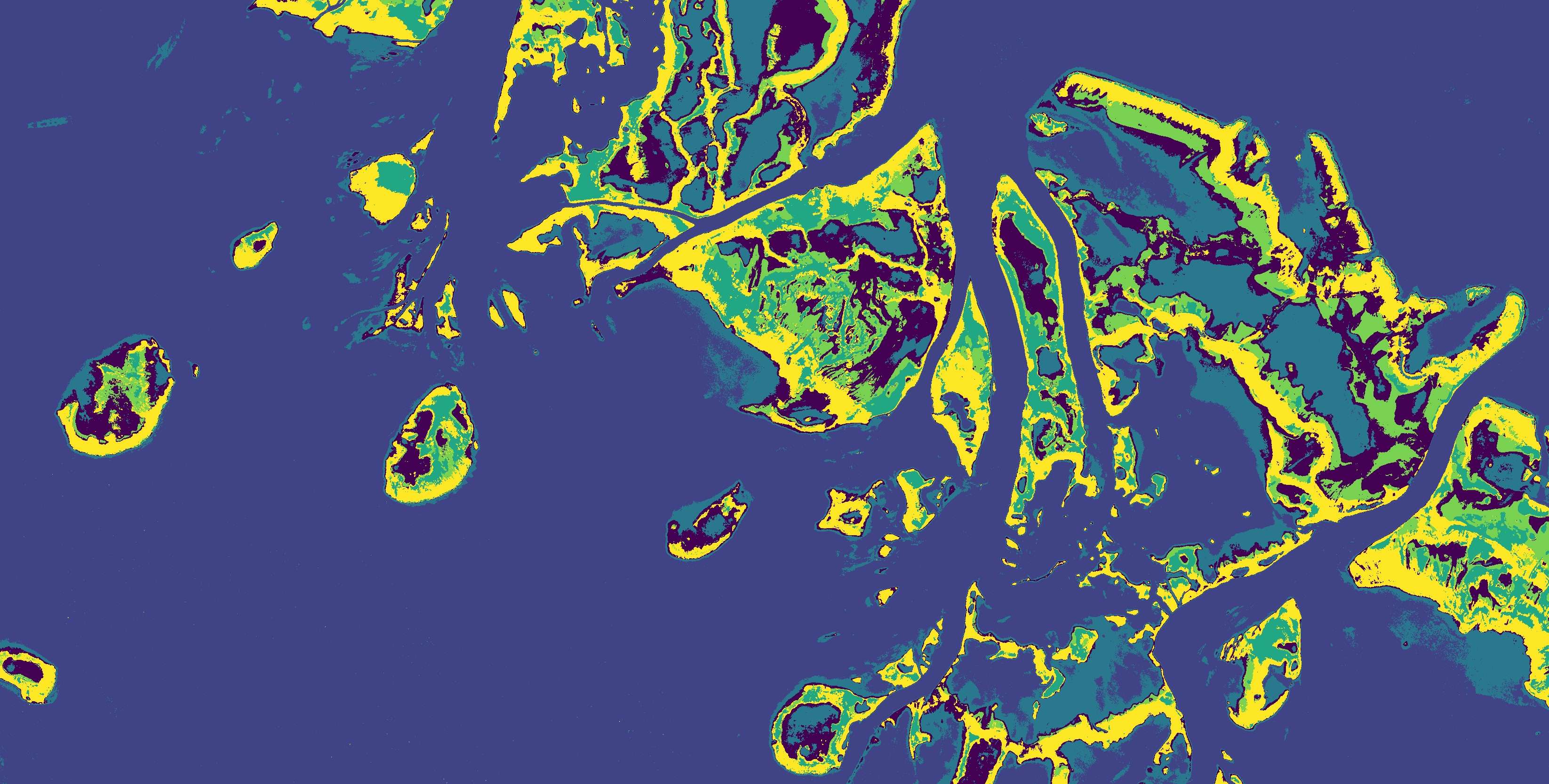
Map seabed substrates, habitats, seagrass, shallow-water features and marine context layers using annotation, training, inference and confidence outputs.
Joint Bathymetry & Seabed Mapping
Multitask AI jointly predicts bathymetry and seabed classes, improving spatial consistency between depth, substrate and habitat interpretation layers.
Object, Vessel & Asset Detection
Detect and monitor vessels, aquaculture cages, floating assets, port structures, infrastructure features and operational activity from EO, UAV and aerial data.
Water Quality & Environmental Indicators
Integrate turbidity, chlorophyll-a, suspended matter, water clarity, Secchi depth, KD490, temperature context and river-plume indicators for monitoring workflows.
Sedimentation & Shallow-Water Change
Monitor siltation, erosion, accretion, access-channel change, coastal dynamics, dredging effects and post-storm impacts using multi-temporal geospatial layers.
IHO S-100 / S-102-Oriented Workflows
Prepare bathymetric surfaces, uncertainty layers, isobaths, transects, metadata and GIS-ready deliverables for hydrographic offices and maritime decision support.
Validation, Reporting & GIS Export
Produce accuracy metrics, uncertainty maps, CATZOC/QoBD-style indicators, technical reports, dashboards, GeoTIFFs, GeoJSONs and API-ready outputs.
Base Export Layers
These views show only the core exported layers: satellite imagery, bathymetry, and pixel-based seabed classification. BlueVision exports much more, including uncertainty, transects, isodepths, validation layers, masks, metadata, S-102-ready bathymetric surface inputs, and analysis-ready geospatial products.