Bathymetry Projects
Applied research & field deployments in AI-driven seabed mapping and refraction correction
Our Bathymetry Projects
Selected projects in which we participated, showcasing spectral-derived bathymetry, refraction correction, archaeological prospection, and operational deployments.
- All
- Refraction Correction
- Spectral Derived Bathymetry
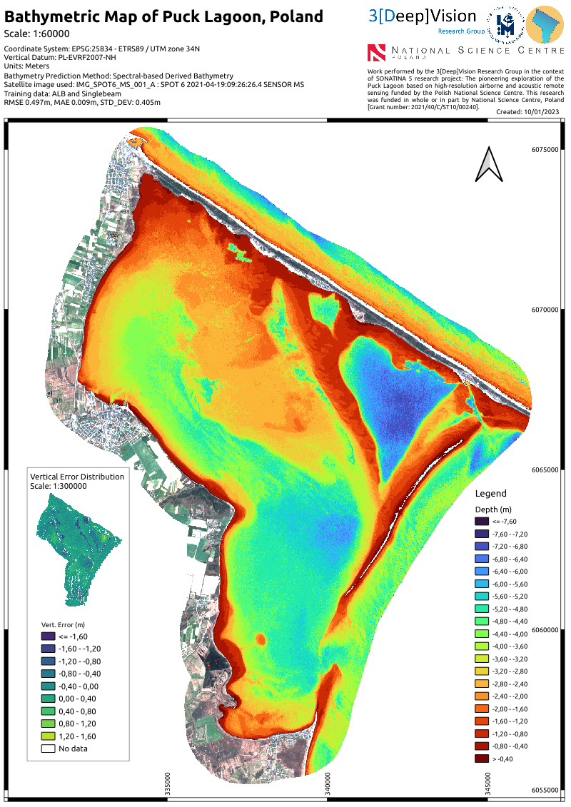
SDB in Puck Lagoon, Poland
Spectral Derived Bathymetry
Work performed in the context of SONATINA 5 research project.
Mapped area: 104 km2
Image Data: SPOT 6 Multispectral Imagery
Reference Data: ALB and Singlebeam bathymetry
Depth range: 0–7.60 m
RMSE 0.497 m, MAE 0.009 m, STD_DEV: 0.405 m
Funding: National Science Centre, Poland (Grant: 2021/40/C/ST10/00240)
Led by Gdynia Maritime University .
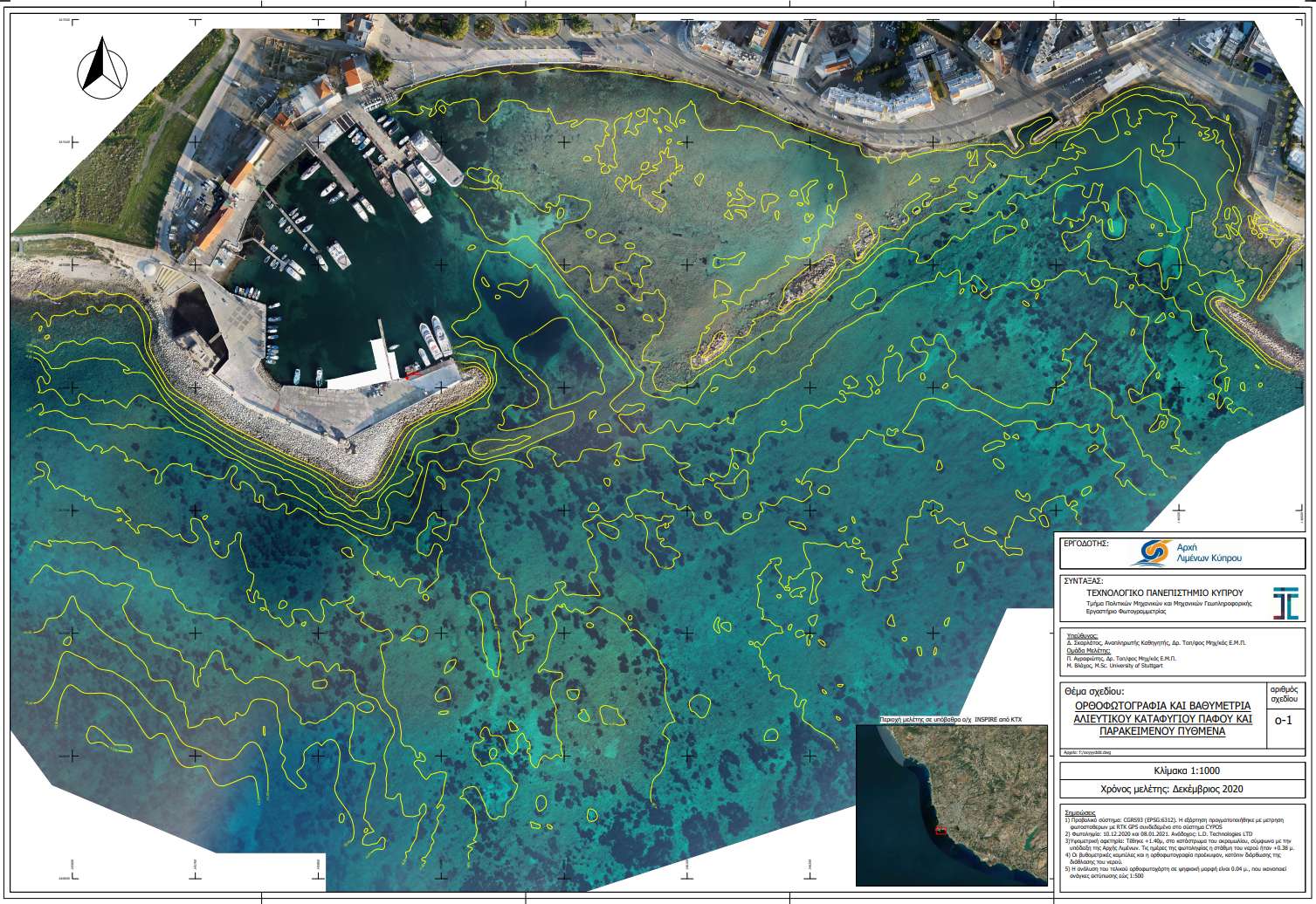
Marina expansion mapping, Cyprus
Refraction Correction with Machine Learning
True* orthoimages for archaeological prospection and isodepth contour lines.
Image Data: DJI Phantom4 Pro
Depth range: 0–10.00 m
Funding: Cyprus Port Authority
Led by Photogrammetric Visin Lab., CUT.
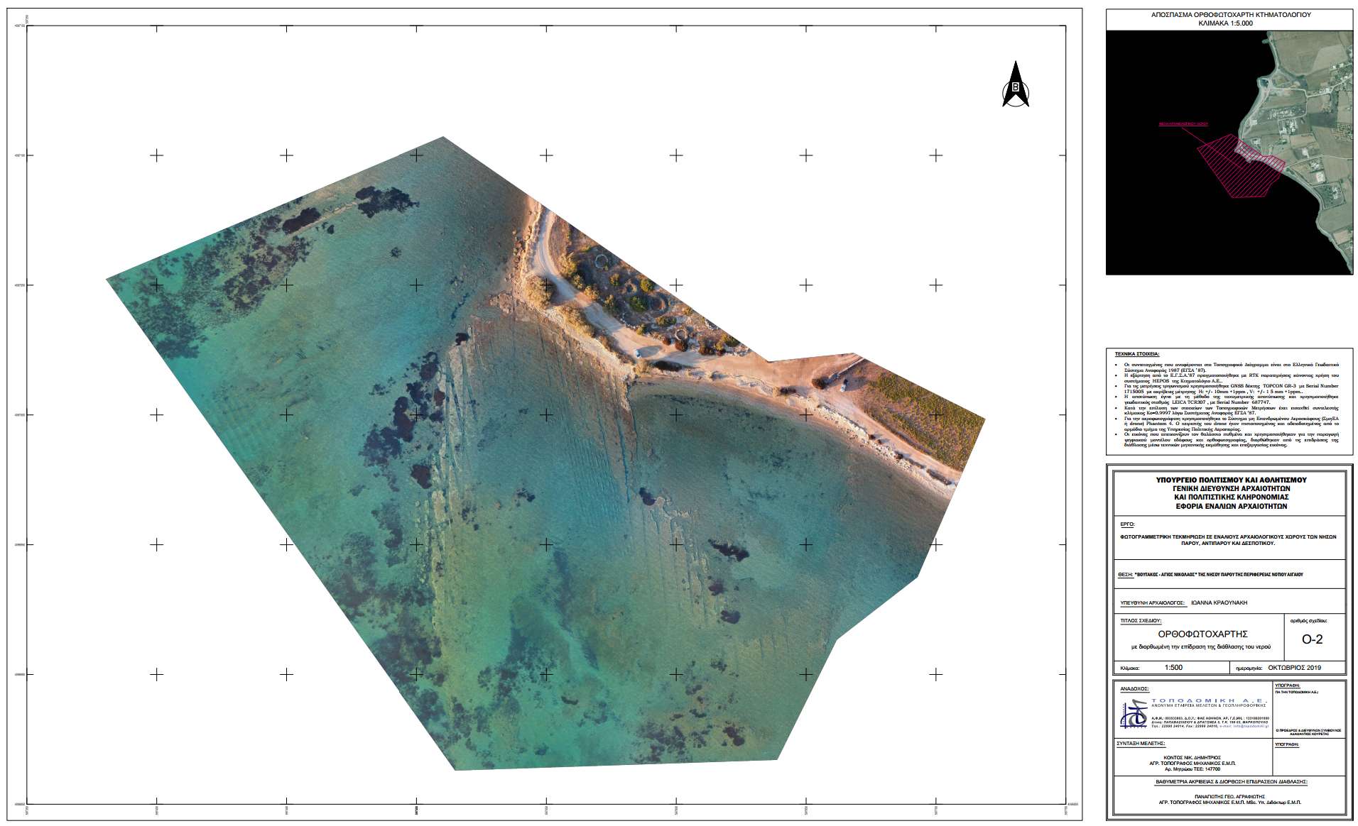
Archaeological mapping, Greece
Refraction Correction with Machine Learning
True* orthoimages for archaeological prospection.
Image Data: DJI Phantom4 Pro
Depth range: 0–5.80 m
Funding: Greek Ministry of Culture and Sports
Led by TOPODOMIKI S.A.
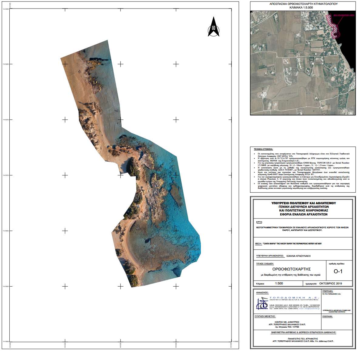
Archaeological mapping, Cyprus
Refraction Correction with Machine Learning
True* orthoimages for archaeological prospection and isodepth contour lines.
Image Data: DJI Phantom4 Pro
Depth range: 0–3.00 m
Funding: University of Cyprus, Marelab
Led by Photogrammetric Visin Lab., CUT.

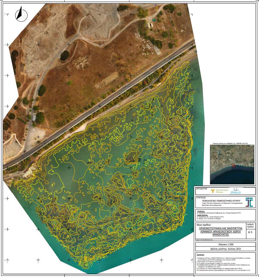
Marina expansion mapping, Cyprus
Refraction Correction with Machine Learning
True* orthoimages for archaeological prospection and isodepth contour lines.
Image Data: DJI Phantom4 Pro
Depth range: 0–9.00 m
Funding: Cyprus Port Authority
Led by Photogrammetric Visin Lab., CUT.
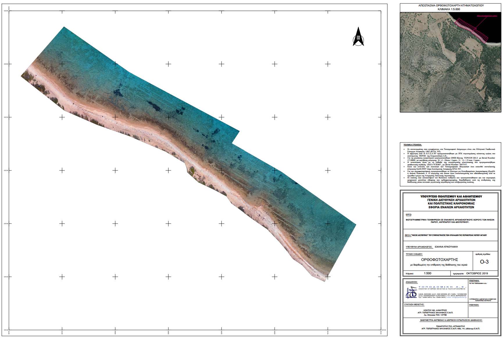
Archaeological mapping, Greece
Refraction Correction with Machine Learning
True* orthoimages for archaeological prospection.
Image Data: DJI Phantom4 Pro
Depth range: 0–6.20 m
Funding: Greek Ministry of Culture and Sports
Led by TOPODOMIKI S.A.
Archaeological mapping, Cyprus
Refraction Correction with Machine Learning
True* orthoimages for archaeological prospection and isodepth contour lines.
Image Data: Vexcel UltraCam Eagle M3
Depth range: 0–13.00 m
Funding: Paphos Municipality
Led by Photogrammetric Visin Lab., CUT.
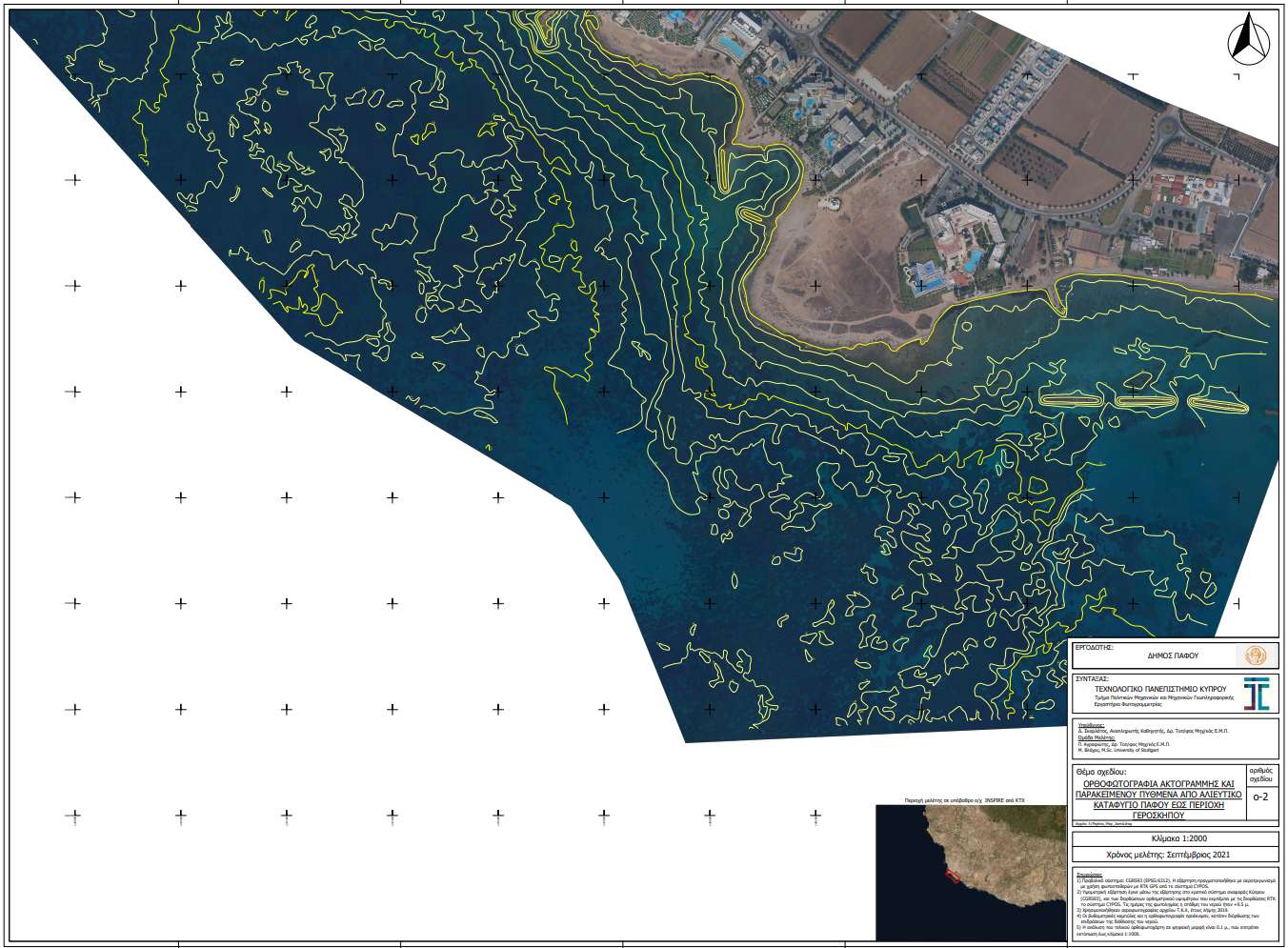
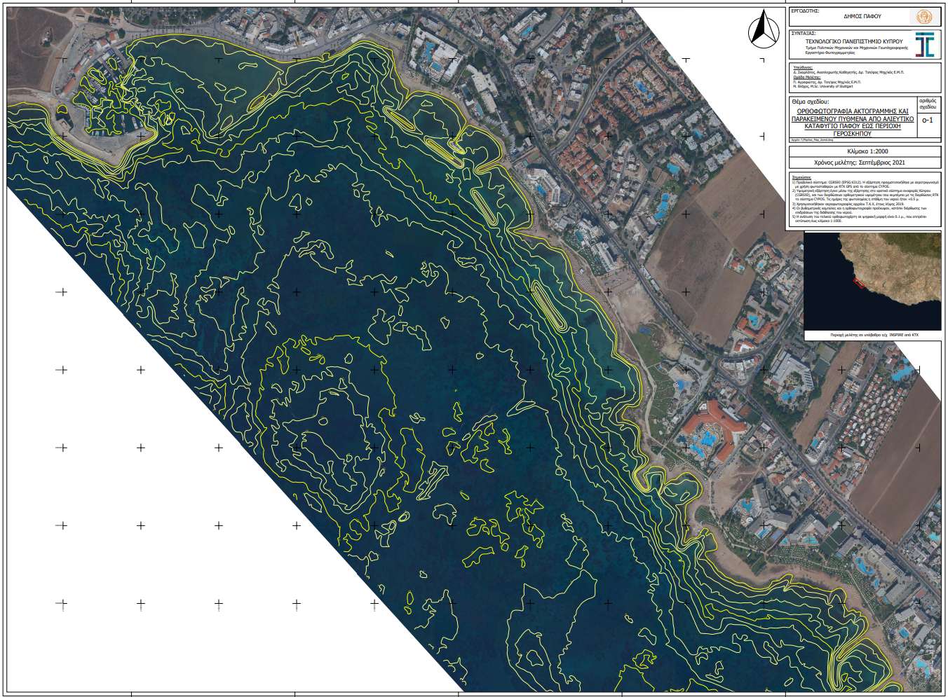
Archaeological mapping, Cyprus
Refraction Correction with Machine Learning
True* orthoimages for archaeological prospection and isodepth contour lines.
Image Data: Vexcel UltraCam Eagle M3
Depth range: 0–13.00 m
Funding: Paphos Municipality
Led by Photogrammetric Visin Lab., CUT.
Archaeological mapping, Greece
Refraction Correction with Machine Learning
True* orthoimages for archaeological prospection.
Image Data: DJI Phantom4 Pro
Depth range: 0–3.80 m
Funding: Greek Ministry of Culture and Sports
Led by TOPODOMIKI S.A.