
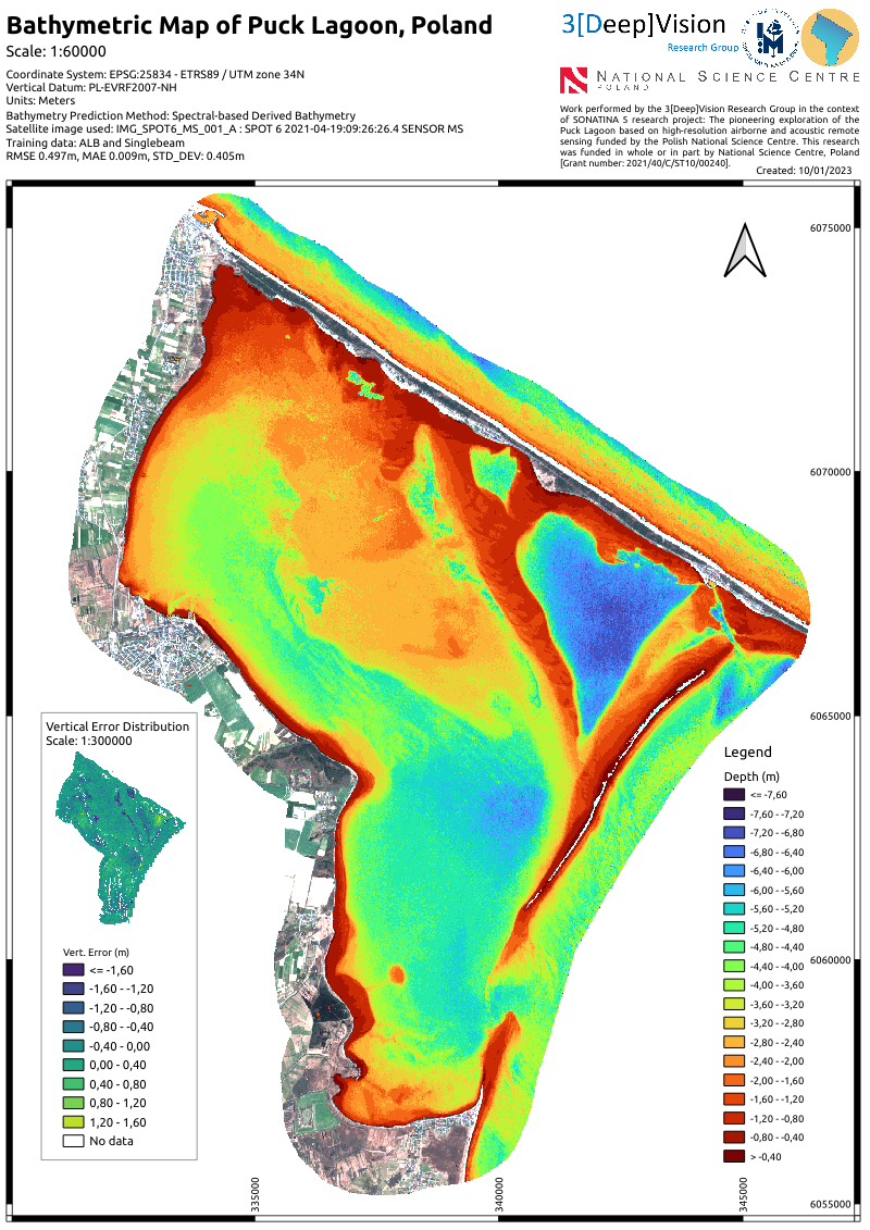
Spectral Derived Bathymetry
Work performed in the context
of SONATINA 5 research project: The pioneering exploration of thePuck Lagoon based on high-resolution airborne and acoustic remotesensing funded by the Polish National Science Centre.
Mapped area: 104 km2
Image Data: SPOT 6 Multispectral Imagery
Reference Data: ALB and Singlebeam bathymetry
Depth range: 0-7.60m
RMSE 0.497m, MAE 0.009m, STD_DEV: 0.405m
Funding: National Science Centre, Poland [Grant number: 2021/40/C/ST10/00240].
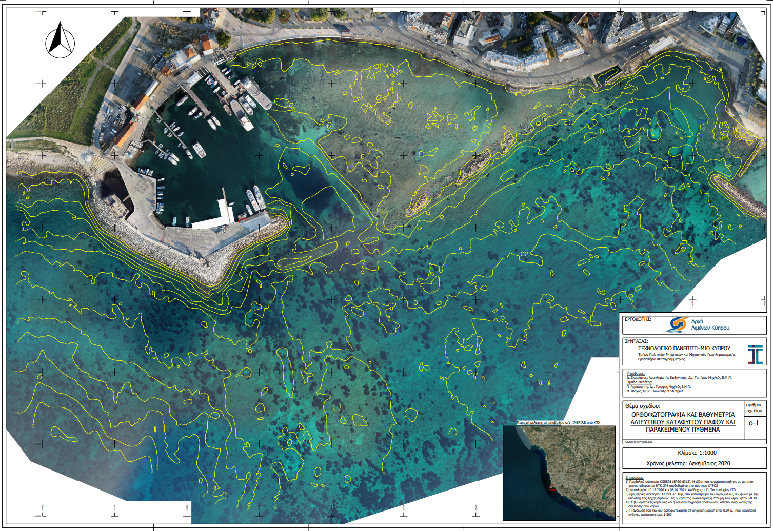
Refraction Correction with Machine Learning and consequently image correction by the refraction effects
True* orthoimages for archaeologigal prospection and isodepth contour lines.
Image Data: DJI Phantom4 Pro
Depth range: 0-10.00m
Funding: Cyprus Port Authority
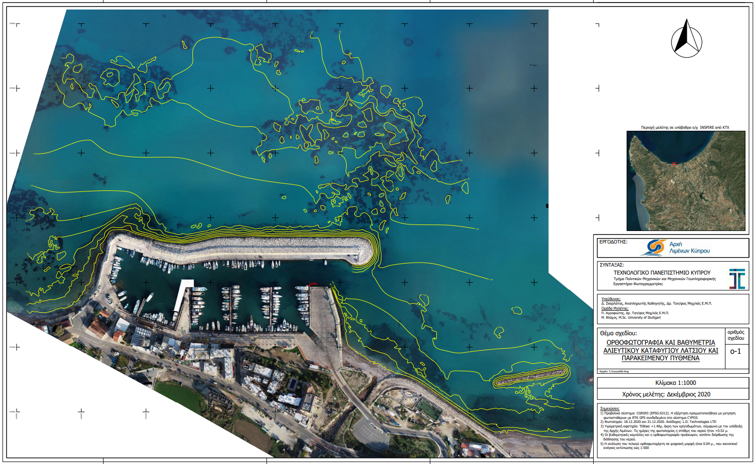
Refraction Correction with Machine Learning for accurate image-based bathymetry
True* orthoimages for archaeologigal prospection.
Image Data: DJI Phantom4 Pro
Depth range: 0-5.80m
Funding: Greek Ministry of Culture and Sports. (With TOPODOMIKI S.A.)
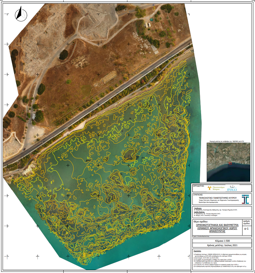
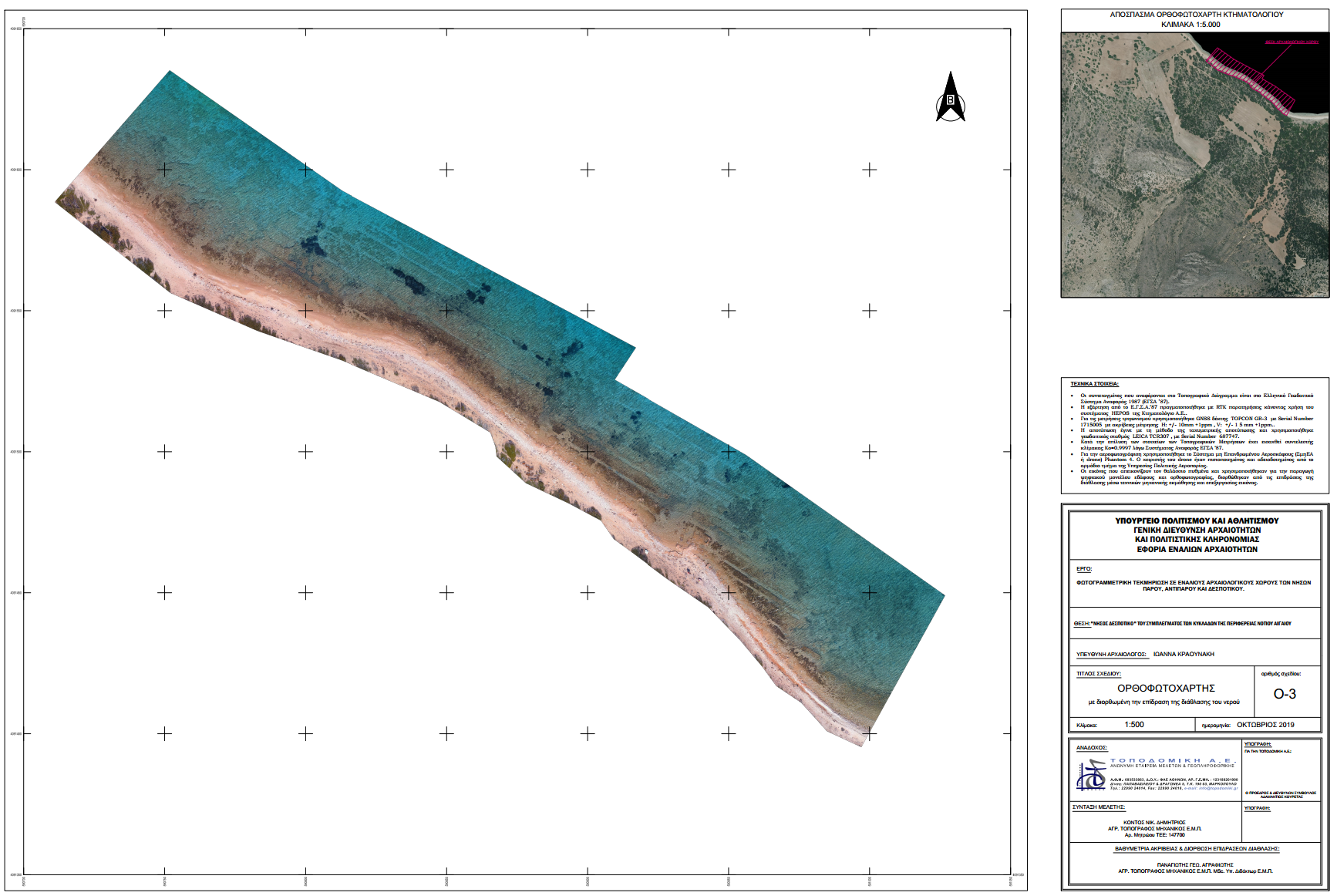
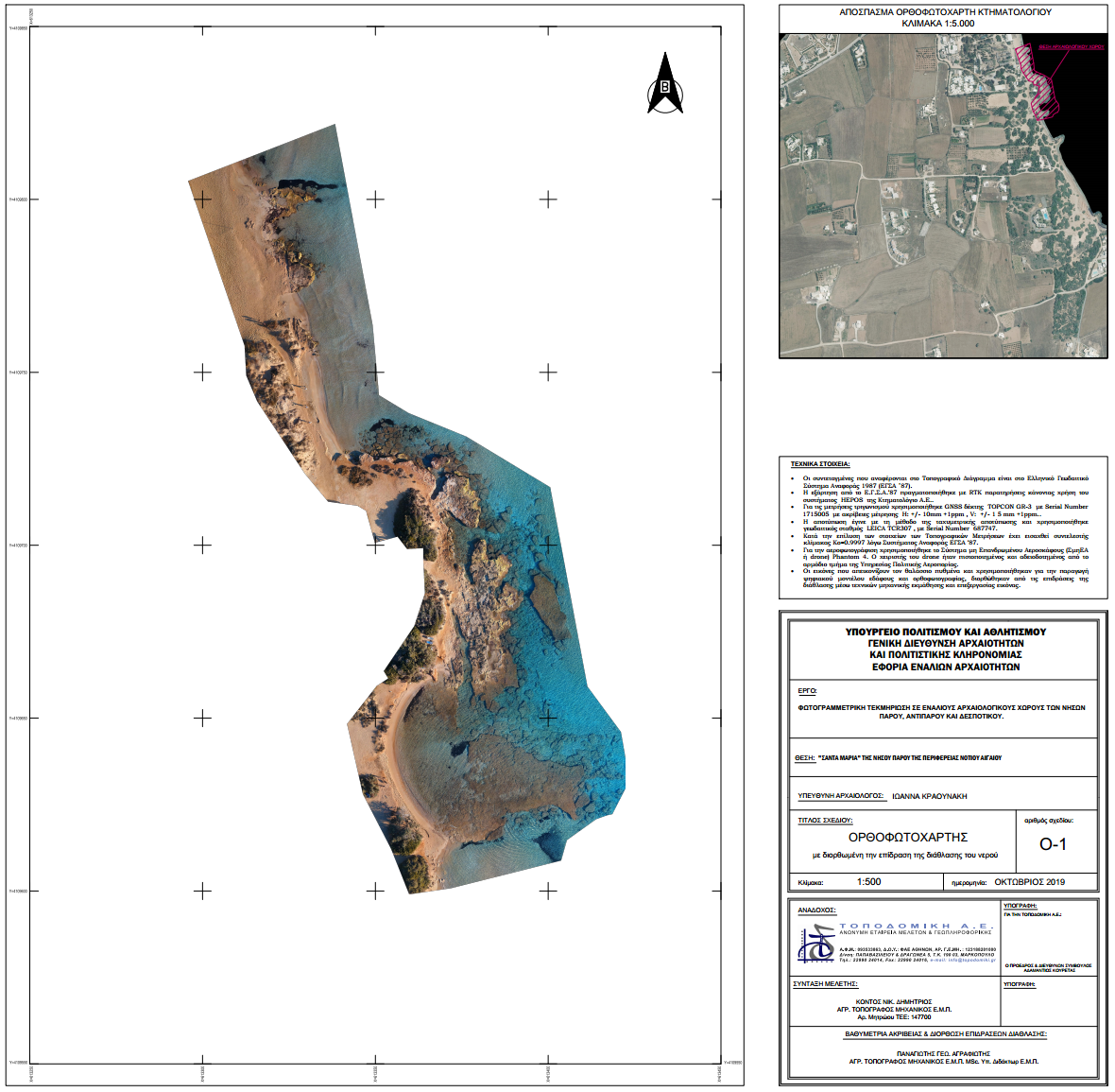
Refraction Correction with Machine Learning and consequently image correction by the refraction effects
True* orthoimages for archaeologigal prospection and isodepth contour lines.
Image Data: DJI Phantom4 Pro
Depth range: 0-3.00m
Funding: University of Cyprus, Marelab
Refraction Correction with Machine Learning and consequently image correction by the refraction effects
True* orthoimages for archaeologigal prospection and isodepth contour lines.
Image Data: DJI Phantom4 Pro
Depth range: 0-9.00m
Funding: Cyprus Port Authority
Refraction Correction with Machine Learning for accurate image-based bathymetry
True* orthoimages for archaeologigal prospection.
Image Data: DJI Phantom4 Pro
Depth range: 0-6.20m
Funding: Greek Ministry of Culture and Sports. (With TOPODOMIKI S.A.)
Refraction Correction with Machine Learning and consequently image correction by the refraction effects
True* orthoimages for archaeologigal prospection and isodepth contour lines.
Image Data: Vexcel’s UltraCam Eagle M3
Depth range: 0-13.00m
Funding: Paphos Municipality
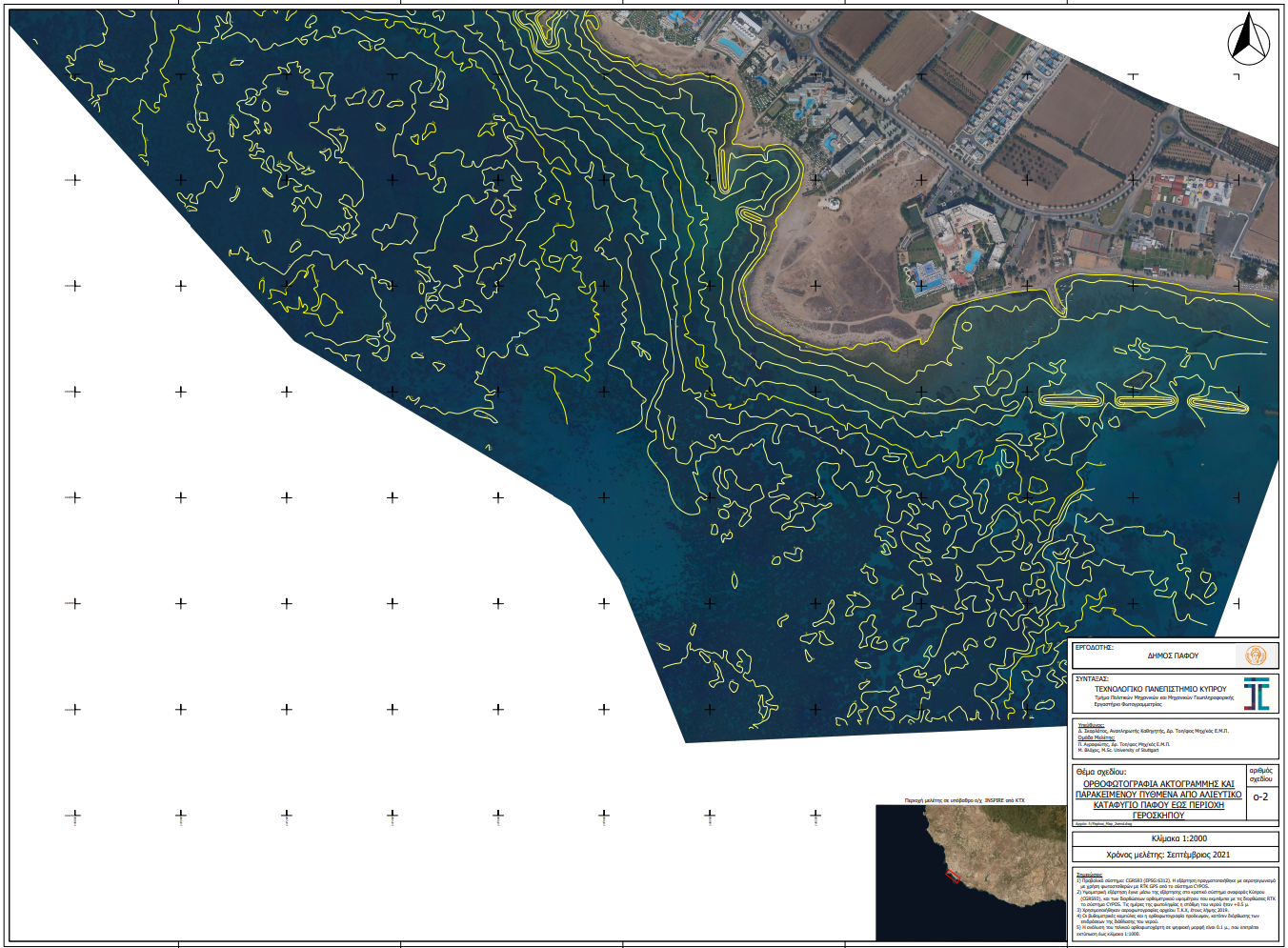
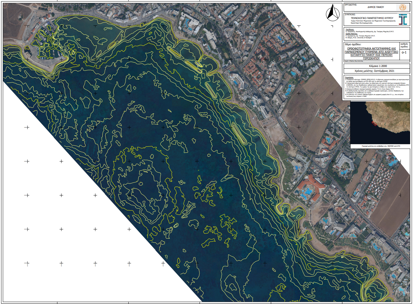
Refraction Correction with Machine Learning and consequently image correction by the refraction effects
True* orthoimages for archaeologigal prospection and isodepth contour lines.
Image Data: Vexcel’s UltraCam Eagle M3
Depth range: 0-13.00m
Funding: Paphos Municipality
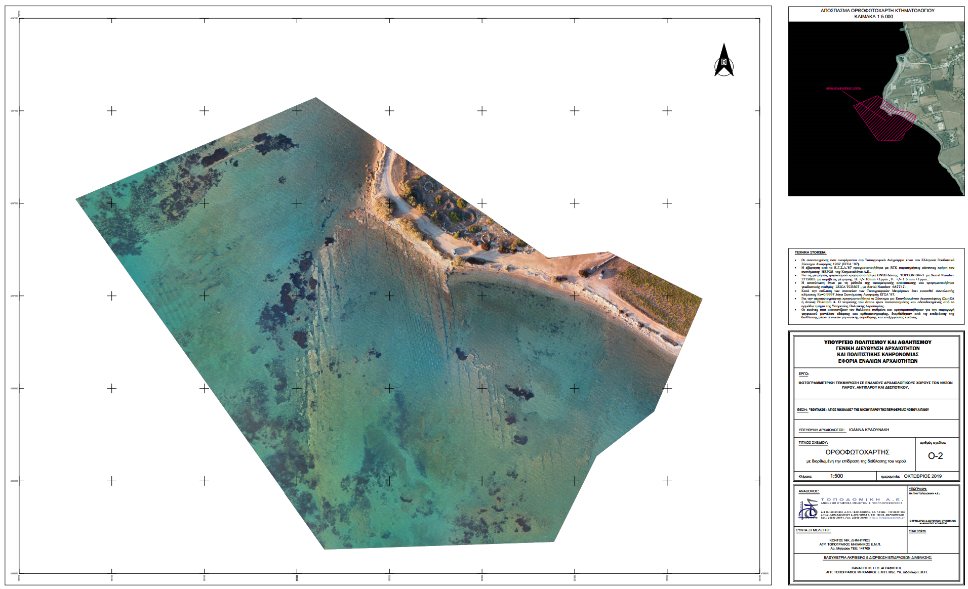
Refraction Correction with Machine Learning for accurate image-based bathymetry
True* orthoimages for archaeologigal prospection.
Image Data: DJI Phantom4 Pro
Depth range: 0-3.80m
Funding: Greek Ministry of Culture and Sports. (With TOPODOMIKI S.A.)